Just had a fascinating 2-hour session on working with geocommons.com, which lets you create all kinds of amazing map/data mashups, using publicly uploaded and shared data sets and shape files. The data behind this map of Male bicycle commuters per region is very old (from the 2000 census) – would love to do the mashup again when the 2010 data comes out in March, to see how it compares.
Takes some tweaking to get the population distributions to tell the story, but here you can see how dramatically bicycle usage increases in urban centers, i.e. where bicycle commuting is feasible, then drops precipitously as you head out toward the ‘burbs.
Be sure to enabled the Legend at lower right to make sense of the shaded regions. My only complaint is that the map has to load all of its data before it can draw shaded regions for the current viewport. But otherwise, wow – this was incredibly easy to do.
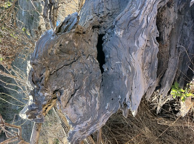
Amazing solo geocaching hike today, starting in Alvarado Park in Richmond, CA. 7.2 miles in nearly 4 hours, absolutely perfect weather. Soon left Alvarado for surrounding areas (some private, some public).
At the peak, looking out over the entire Bay Area and meditating on the people I love, struck again by just how majestic the Bay Area is on a perfect day. Spiritual moment.
Took a wrong turn off the peak and ended up in Richmond neighborhoods… which wasn’t all bad — had a grand tour of the East Bay Waldorf School (solar powered art studio, log cabins, little racks full of galoshes so students can play in the rain) before heading back up and over the hill through private property (hopped a barbed wire fence, but worth it). Found myself in some insane machete territory without a machete, powering through blackberries, poison oak and thistle for half a mile – I was committed to the route by that point.
Lesson: Don’t rely on old geocache data in the GPS. Last time I had loaded up this area was in 2008, and several caches had gone defunct in the mean time, including one I really wanted to get in an elaborate hut made of sticks. At another point, found myself in the middle of a herd of cows looking for something that didn’t exist. Mother cow very protective toward her calf, had to move slowly and not provoke.
Also made some experimental photos with the new HDR setting in iOS 4.1, below.
(Click for full-size version). HDR mode doesn’t always work perfectly, but when it does, it’s amazing.
Amazing weekend in the Sierras with Miles and my parents, highlighted by a 5.4 RT hike to Lake Margaret, off Highway 88. Weather report had called for rain, but we lucked out with sunshine that morning. By the time we made it to 7,700 feet elevation, just past Kirkwood Ski Resort, the temp had dropped to 40 deg farenheit (in August!)… and I was in shorts and shirtsleeves (fortunately had a sweatshirt and pants on hand for Miles).
The hike is a non-stop visual barrage of geological awesomeness – trekking across great slabs of granite pushed clean by a passing glacier some tens of thousands of years ago. Ancient cypress and bristlecone pines windswept into impossible shapes, tarns left behind by glaciers melting in place, trees cut short by beavers, just like in cartoons. The round trip was about the same length and technical difficulty as the Kalalau trail we did in Kauai, but the mile-high-plus elevation did a number on us – you get tired a whole lot faster with the reduced oxygen.
Tracked down a couple of geocaches on the trip. As we approached the first, hail started to trickle down on us, and on my bare legs. Had to keep moving to stay warm. The second geocache was hanging in a tree on top of a great granite slap pushed up by forces you shudder to imagine. It was a level 4 terrain cache, and we spent a good bit of time talking about how serious it would be to get injured miles from anywhere, and what it would mean to get helicoptered out. We agreed not to do anything stupid, to move slowly, not make any hasty decisions. Miles got it. Still, halfway up to Dawg Years we decided to back out and not go any further… until we spotted the secret back way up to the lonely windswept pine that we were certain held the cache. From there on it was easy going, and I let Miles do the honors.
It only got colder on the way back, as we listened to thunder rippling across the valleys, signaling the start of rain. Incredibly lucky – we only got sprinkled on, but it started to pour buckets just after we got in the car.
Decided to see what the camera in the iPhone G4 was capable of, and took all of these images with it. Impressed overall, but they’re still not at the quality of images from the PowerShot. From now on, will continue to hike with the PowerShot, but will be stoked to have the iPhone on-hand for spontaneous quickies.
Elevation profile:
Unfortunately, the weekend ended badly, when Mom slipped on gravel heading down to Cat Creek, where we were planning to do some swimming in the melt water. I was 10′ in front of her when I heard the “oomph,” and turned around to see her ankle bent at a very wrong angle. Dad and I hoisted her back to the car, and she ended up in the E.R. She’ll have to have a plate installed, and will be laid up for quite a while. Best luck and love to both of them getting through this – a horrible thing to witness and it won’t be pleasant for the next month. Much love.
It’s sometimes said that Kauai is the last remaining vestige of “the old Hawaii” or “the real Hawaii” – the last bastion of island life as it was before much of it was taken over by hotel chains and tourism. Kauai isn’t without its share of commercialism, but it’s true that it’s almost entirely free of high-rise hotels, and that natural wonders abound.
At the same time, some of your old-school stereotypes about Hawaii just aren’t going to come true. Visitors are no longer greeted on the tarmac with a flower lei around the neck, you aren’t going to hear ukulele concerts or witness spontaneous hula dances on every corner, and luaus are no longer organic affairs where people sit around on the beach sipping Mai Tais and picking meat off a pit-grilled pig, scooping three-finger poi with bare hands.
To be fair, your visions of stereotypical Hawaiian nature are still real, while the stereotypes you may hold of Hawaiian culture are probably not.
Kauai is encircled – for the most part – by a single road running through a dozen or so major towns. You can drive around the entire island in a couple of hours (note that “driving through” does not equal “exploring,” and that driving the outer rim will only get you to the beach towns, not to the juicy jungles that comprise Kauai’s interior). I say “for the most part” because the insane terrain of the Napali coast has proven impenetrable to road builders – it’s simply not possible to build a drivable road through the mountains of the northwest coast.
You won’t find the “real” Kauai by hanging around in the downtown areas. But if you make an effort to get even a little off the beaten path, you will find yourself surrounded by nature at its most powerful. Kauai is a volcanic wonderland of dense jungle, incredible ocean life, succulent wild fruit, and loose chickens.
Throw yourself into the environment, and you won’t be able to avoid swimming in impossibly blue/green waters, inhaling the cleanest air your nostrils have ever encountered (remember you’re surrounded on all sides by thousands of miles of wild Pacific). You will find that the Aloha spirit is omnipresent and real. You will find yourself slowing down, being reminded why you’re walking this earth, and what nature at its most raw can do for your soul.
In June/July 2010, we spent two weeks in Kauai, staying in two different houses with two different families, in two very different environments. In the end, I shot more than a thousand photos. Thought I’d turn all my vacation notes and photos into a quick blog entry on return; the process ended up taking a couple of days — which was OK since I needed that time just to transition back to “real” life and get the hang of cold weather and the absence of snorkeling grounds outside my back door. Editing the photos down to a “mere” 470 and filling in the details from my notes turned out to be the perfect obsessive/compulsive transitional gig.
Photos: Here’s the Flickr standard photo set view, but much better is the Flickr lightbox view. I’ve also embedded a slideshow version below, but for best results dim the lights, put some Hawaiian music on the hi-fi, and put your browser in full-screen mode.
Note: I lost my camera on the very last day — turned out I left it under the seat in the rental car — so the set isn’t quite complete. Fortunately I had been backing up the camera’s contents to iPhoto throughout the trip, so had an almost complete set. Super-lucky news is that Budget Rent-a-Car in Lihue found the camera and is returning it to me; I’ll add the final images when it arrives. Thanks Budget! Continue reading “Kauai 2010”
Another great solo day trekking Bay Area backroads – this time to Mt. Diablo. Not having a full day to play with, drove in half way and parked at a placed called Junction, then hit the Summit trail and hiked all the way up. 82 degrees heading in, but temps dropped as I neared the peak. Wind started whipping, and black streaks of rain separated from the clouds. Only ended up getting dumped on for five minutes, thankfully. Exhausted by end of day.
Surpassed the 300 geocache finds marked, and then some. Also nabbed three “earthcaches,” which have no container or log but instead are about discovering and learning about some unique geological feature. Highlight of day – doing the multi-cache at the summit. After I had done the math and got to the final location, took the cap off a fencepost and was greeted not by the cache but by a colony of swarming earwigs, right out of a horror movie. Awshum.
Some devilishly clever containers today – like the normal-looking pinecone shown, and the fake plumbing – you had to remove the pipe assembly, then turn the valve and a Bison tube tumbled out. Loved it.
Slideshow above does not include captions – view set at Flickr for those.
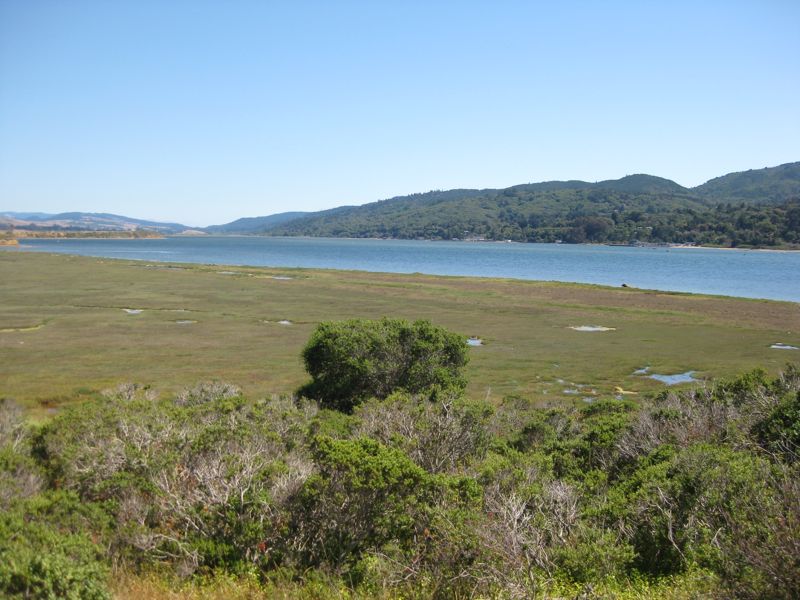
Playing bachelor for a few weeks while Amy and Miles spend time in Minnesota and I return to CA to get back to work. Taking the opportunity to do things I never get to do with family… like spend an entire day hiking rather than just a couple hours. Yesterday decided to geocache the entire rim of Tomales Bay. Knew it would have to be a combined drive/hike thing. Ended up driving almost 200 miles total, and hiking 15.
Day got off to a bad start with horrendous Bay Area July 4th exodus traffic, overcast skies, and a starter string of three DNFs (Did Not Finds). But things quickly turned around – everything turned gorgeous when the sun came out, the caches kept getting better, and the hikes got longer. Favorite cache of the day was Crivens! – on a peninsula half-mile off the road. Trekking through walls of blackberry taller than me, out toward a perfect blue bay, with amazing views. While most caches are filled with forgettable geo-crap, this one had an excellent Mullet-scented air freshener (yes, that kind of mullet) and a USB “humping dog.”
The west side of the bay was quite a bit trickier, since most of the rim is in State Park area. Access to caches much harder than it appeared on a map. Decided to hike to Johnstone rather than pay the $6 parking fee. So glad I did – descended through deep dark woods with bluebirds and chipmunks, got some major heart pumping action on the way back up. Dropped off some travel bugs I had carried home from Minnesota.
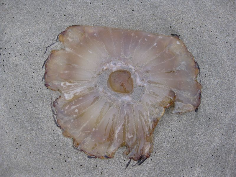
The scene changed completely for the last cache of the day as I headed toward the Pacific side for Kehoe Beach earthcache. Suddenly it was about salt mist and jellyfish, sand and dense fog. Reminded me of Morro Bay. This one was a major geology lesson – needed to photograph quartz veins running through granite cliffs and read about five pages of text on the local geological forces to answer the questions needed to log the find. If I nail it, will be my first verified earthcache find.
Getting very close to hitting the elusive 300-cache mark… but I’d much rather spend two hours on a great hike for a single well-placed cache than do 15 parking lot drive-bys in the same amount of time. The key is to remain process-oriented, rather than goal-oriented, and never let the drive for numbers outweigh the joy of the great outdoors and honest exercise.
Wrapped day with a well-earned dinner of Full Sail and raw / BBQ’d oysters at Tony’s. BBQ’d is nice, but IMO the only way to show an oyster your full respect and attention is to eat it raw. Heaven.
Completely fried by end of day. Showered, fell onto couch, and watched the fantastic but campy 1971 eco-disaster sci-fi flick Silent Running ’till I passed out.
Animated route from GPS (combined driving/hiking):
Wrapping up an excellent – but sad – 10 days with relatives in Minnesota. Excellent because Minnesota is always excellent this time of year, lush and verdant, with endless trails and meadows fed by those famous 10,000 lakes. Excellent because it was wonderful to see family and because I really needed the downtime. Sad because we were there to say farewell to my father-in-law, who passed away a few weeks ago and is deeply missed by all of us.
Click Replay for hike animation
Wrapped up the visit with a lovely 3-mile walk through Carver Park Reserve with the family and kids through rolling hills. Returned with a few tics and lots of great memories.
Despite yesterday’s post on difficulty of getting the sapling out of the house for family hikes, had the opposite experience today. Last day of long weekend, yet another unexpectedly gorgeous mid-winter day, the three of us headed for Redwood Regional for a strenuous but truly awesome three-miler. Started at Moon Gate staging area, then descended deep into a valley of giant redwoods, down with the dinosaur ferns and cool streams. Ironic – sunny day, but spent the afternoon in deep shade, beyond where rays could penetrate. The squirt was great and scampered down trails and across logs fallen over creeks just like old times. Hardly a complaint. Fantastic day.
Finally got around to figuring out how to edit GPS tracks with Garmin Bobcat (stupidly renamed Garmin RoadTrip), and upload to TrailGuru:
(press Replay for trail animation). Elevation map screenshot from RoadTrip:
If you’ve been following my geocaching rants for a while, you’ll know that my son Miles (6) has been my constant caching companion for the past couple of years. Since he was 4 1/2, I’ve been able to blurt out “Let’s go grab a cache!” and he’s been ready to hit the trail at the drop of a hat. Rain or shine, urban or deep woods, he’s been game to go. When he got old enough to realize that most geocache prizes were more like geo-crap than actual hidden treasure, it didn’t matter – he knew it would still be an opportunity to climb trees, get muddy, play with sticks, find bugs, vault fences and run scrambling down a dirt track, getting his ya-yas out.
A few months ago, all of that started to change. Somewhere along the way, he began to realize that every hour out hiking was an hour not building Legos or making stories at home. And while he was good for five-milers from a very early age, at some point he figured out he could claim to be “tired” after the first 200 yards, and even that passive resistance (laying down in the middle of the trail) was an effective way of brining an excellent afternoon outing to a grinding halt. I’m not positive, but think he learned this from watching other kids do it on group outings. Big ears, and alla that.
It’s a drag. What for the past couple of years had seemed like the perfect father-son bonding activity had often become a wrestling match when it came to getting out of the house. Of course, he usually had fun once he hit the trail, but his little power plays to resist the very idea of going out have become both more strident and more devious. Along the way we mutually recognized that a certain amount of negotiations would do the trick: “If I go geocaching with you today will you play Lego Star Wars with me tonight?” (an excellent deal for me, since I secretly love playing Lego Star Wars).
But even that tactic may be losing its effectiveness. After Amy informed him that we were going to do a big hike tomorrow, he apparently complained: “The last day of Thanksgiving vacation, ruined by a hike? Why do you guys even think I like it? I’m not even an outdoors kind of guy!”
Ouch. Why don’t you just put me in a resting home right now, little squirt? Our Ultimate Bonding Activity, totally up-ended. OK, so you’re not into geocaching anymore. I can live with that. But “Not an outdoors kind of guy?” Where did you even learn an expression like that? And is that an example of genuine self-knowledge, or just an extension of increasingly sophisticated rhetorical ploys to let you stay home and play? And how can I make hiking feel more like play to you?
Well, Sid the Science Kid recently told you all about the importance of getting a good dose of cardio daily, and you seemed to buy that. But Sid or no Sid, just don’t wound your dear old dad like that, eh? Ouch.
Readers following this blog have seen my occasional references to geocaching – a sport/hobbby/pastime that Miles and I do quite a bit of, which involves using a hand-held GPS to place and find hidden treasures – either in the woods or in the city.
One of the many unusual aspects of geocaching is the fact that it relies completely on the existence of a single web-based database, represented by the site geocaching.com. As web-based database applications go, the site is a modern marvel. The database represents hides, finds, people and their discovery logs, travel bugs (ID’d items that travel the world, hopping from container to container), and more, all sliced and diced a million ways to Sunday. The site is deeply geo-enabled, letting users hone in on hides near them, along a route, or near arbitrary destination locations. It’s also one of the best examples I’ve seen of useful Google Maps mashups, relying heavily on the open APIs provided by Google to integrate its cache database with Google’s map database. This is what map mashups are all about, and geocaching.com has done an amazing job with them.
As the popularity of personal GPSs rises, so does the game’s popularity. But when geocaching.com goes down (or slows down), so does the game, which involves more than half a million hides world-wide, and many millions of players. The site, which is, sadly, based on Microsoft database technology and ASP, does go down from time to time (big surprise); it’s a “single point of failure” in bit-space for the entire meat-space game – a precarious position. Continue reading “Notes on Open APIs”


 Readers following this blog have seen my